Detail
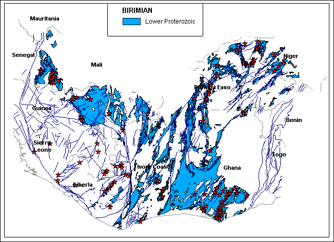
Lower Proterozoic Rocks and Faults
Concessions and Gold Deposits on DEM
| West
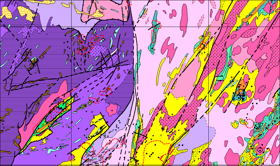
Africa Geology and Mineral Occurrences: A dataset for use in Geographic
Information Systems
Version 1.1 2-10-98
Version 1.1 2-10-99
This dataset is for use as a single copy and may not be distributed to others. Those wishing to do so should make arrangements with GeoMax. Projection: Equidistant Cylindrical Datum: WGS 84 Description of the constituent files are provided as metadata geology.txt, metadata basemap.txt and metadata mineralization.txt. Attributes1.txt contains full field names for the geology or geo_poly file and it can also be used if one prefers to deal with the geologic attributes through a query or join table. Joining can be done on the Number field. Presently all the attributes are held in the geo_poly file. Attributing of the geology including lines and lithologies is derived from the text and legend of Milesi, 1989 and should be relatively clear on its own to a geologist familiar with the area or explicit with reference to the original text. The mineral occurrences and ore deposits
are attributed with information from the legend of the original map, not
directly from the tables in the text as these have no location information.
The ore deposits could be partially referenced against the table in the
text by name. The mineral occurrences on the map have no names and thus
cannot be easily be referenced.
Version 2.0 3-15-99
Custom analysis, map production and/or reports avaiable. For question about this data set, custom work, pricing and purchase orders contact GeoMax. |
||
|
|||||||||
|
Fax: 303-449-0280 Email: geoinfo@geomax.com |
||